| home | research | teaching | pictures | links | ||||||
|
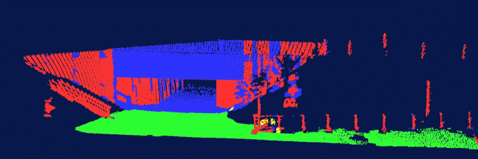
Patrick Pfaff and Wolfram Burgard An Efficient Extension of Elevation Maps for Outdoor Terrain Mapping abstract: Elevation maps are a popular data structure for representing the environment of a mobile robot operating outdoors or on not-flat surfaces. Elevation maps store in each cell of a discrete grid the height of the surface the corresponding place in the environment. The use of this 2 1/2 - dimensional representation, however, is disadvantageous when it is used for mapping with mobile robots operating on the ground, since vertical or overhanging objects cannot be represented appropriately. Such objects furthermore can lead to registration errors when two elevation maps have to be matched. In this paper we propose an approach that allows a mobile robot to deal with vertical and overhanging objects in elevation maps. We classify the points in the environment according to whether they correspond to such objects or not. We also describe a variant of the ICP algorithm that utilizes the classification of cells during the data association. Experiments carried out with a real robot in an outdoor environment demonstrate that the scan matching process becomes significantly more reliable and accurate when our classification is used. Bibtex:
@string{fsr = "Proc.~of the Int.~Conf.~on Field and Service Robotics (FSR)"}

@InProceedings{pfaff05fsr,
  author     =  {Pfaff P. and Burgard W.},
  title      =  {An Efficient Extension of Elevation Maps for Outdoor Terrain Mapping},
  booktitle  =  fsr,
  year       = {2005},
  pages      = {165--176},
  address    = {Port Douglas, QLD, Australia}
}
PDF-File: paper 1.2 MB pdf-file. Multimedia: 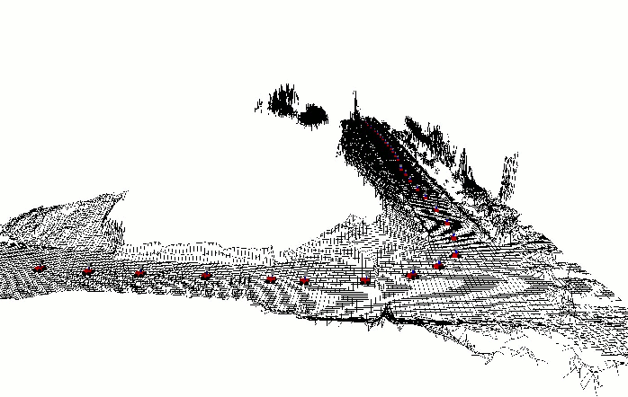 Elevation
Map Video 4.02 MB avi-file.
Elevation
Map Video 4.02 MB avi-file.
 Classified
Point Set Video 1.66 MB avi-file.
Classified
Point Set Video 1.66 MB avi-file.
|